Walk by Betws-y-coed
- Distance: 2.1 Km
- Elevation gain: 105 m
- Maximum elevation: 130 m
- Elevation loss: 98 m
- Minimum elevation: 24 m
- Moving time: 36 m 25 s
- Moving speed: 3.4 Km/h
- Maximum speed: 7.5 Km/h
- Total time: 36 m 25 s
- Global speed: 3.4 Km/h
- Date: 04/04/24
Interactive map
GPS track profile
About this GPS track
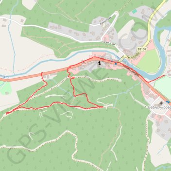
Name: Walk by Betws-y-coed GPS track, route, trail
End: A5, Betws-y-coed, Conwy, Wales, LL24 0BN, United Kingdom (53.09320 -3.81264)
Coordinates: 53.09110 -3.81568 53.09397 -3.80240
Other GPS tracks
Click on a GPS track to view route, its statistics and profile.
TT22 J9 M7/06 : Heysham Port à Aberystwyth
Royaume-Uni > Angleterre > Lancashire > Lancaster > Morecambe
Distance: 347.4 Km • Elevation gain: 4,043 m • Maximum elevation: 419 m