T2020-01-26-12-02
- Distance: 12.0 Km
- Elevation gain: 435 m
- Maximum elevation: 355 m
- Elevation loss: 436 m
- Minimum elevation: 64 m
- Moving time: 3 h 8 m
- Moving speed: 3.8 Km/h
- Maximum speed: 15.4 Km/h
- Total time: 3 h 42 m
- Global speed: 3.2 Km/h
- Date: 26/01/20
Interactive map
GPS track profile
About this GPS track
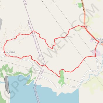
Name: T2020-01-26-12-02 GPS track, route, trail
Coordinates: 35.64315 -5.73425 35.66240 -5.69074
Other GPS tracks
Click on a GPS track to view route, its statistics and profile.
Maroc en boucle depuis Tanger
Maroc > pachalik de Tanger > Tanger
Distance: 3,028.7 Km • Elevation gain: 27,253 m • Maximum elevation: 2,301 m