Ecu_28_Tungurahua
- Distance: 24.1 Km
- Elevation gain: 3,142 m
- Maximum elevation: 4,994 m
- Elevation loss: 3,142 m
- Minimum elevation: 1,880 m
Interactive map
GPS track profile
About this GPS track
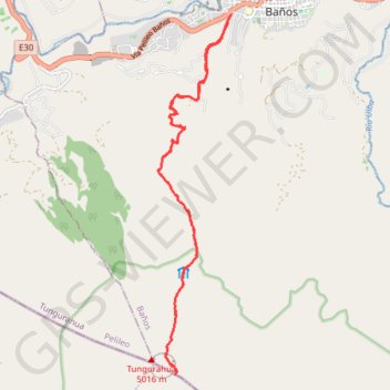
Name: Ecu_28_Tungurahua GPS track, route, trail
Start: Baños, Baños de Agua Santa, Baños, Tungurahua, 280001, Équateur (-1.39864 -78.43330)
End: Baños, Baños de Agua Santa, Baños, Tungurahua, 280001, Équateur (-1.39864 -78.43330)
Coordinates: -1.47018 -78.44790 -1.39864 -78.43330