Alausi-Nariz del diablo por Nizag
- Distance: 17.5 Km
- Elevation gain: 907 m
- Maximum elevation: 2,329 m
- Elevation loss: 926 m
- Minimum elevation: 1,840 m
- Moving time: 3 h 31 m
- Moving speed: 4.9 Km/h
- Maximum speed: 13.1 Km/h
- Total time: 3 h 55 m
- Global speed: 4.4 Km/h
- Date: 14/09/16
Interactive map
GPS track profile
About this GPS track
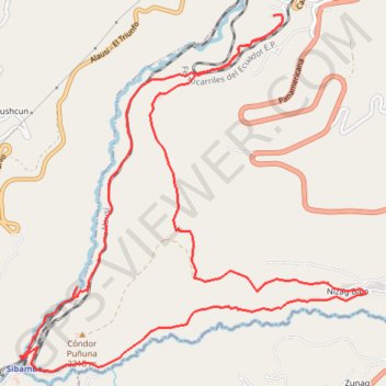
Name: Alausi-Nariz del diablo por Nizag GPS track, route, trail
Start: Calle 6, Alausí, Chimborazo, 060250, Équateur (-2.20910 -78.85179)
End: Calle U, Alausí, Chimborazo, 060250, Équateur (-2.20825 -78.85261)
Coordinates: -2.24458 -78.87854 -2.20810 -78.84317
Other GPS tracks
Click on a GPS track to view route, its statistics and profile.
Alausi-Nariz del diablo por Nizag
Équateur > Chimborazo > Alausí > Alausí
Distance: 17.5 Km • Elevation gain: 909 m • Maximum elevation: 2,329 m