Mount Lafayette Loop
Interactive map
GPS track profile
About this GPS track
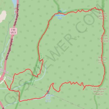
Name: Mount Lafayette Loop GPS track, route, trail
Coordinates: 44.13625 -71.68125 44.16166 -71.64348
Other GPS tracks
Click on a GPS track to view route, its statistics and profile.
Little Haystack Mountain, Mount Lincoln and Mount Lafayette Loop
United States > New Hampshire > Grafton County > Lincoln
Loop hike from Franconia Notch via Falling Waters Trail, Stairs Falls, Swiftwater Falls, Cloudland Falls, Little Haystack Mountain, Franconia Ridge Trail, Mount Lincoln, Mount Lafayette, Greenleaf Trail, Greenleaf Hut and Old Bridle Path in the Franconia Notch State Park and the White Mountain National Forest. #Hike #Loop #Mountain…
Distance: 13.1 Km • Elevation gain: 1,146 m • Maximum elevation: 1,582 m