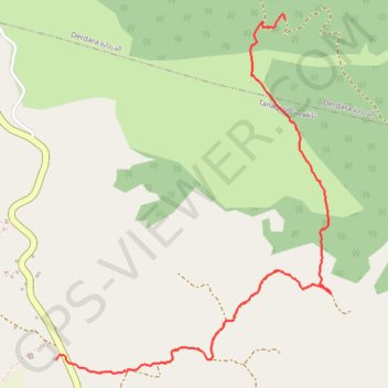
Saved_2020-02-02-11-12
- Distance: 3.8 Km
- Elevation gain: 422 m
- Maximum elevation: 1,048 m
- Elevation loss: 0 m
- Minimum elevation: 625 m
- Moving time: 1 h 7 m
- Moving speed: 3.4 Km/h
- Maximum speed: 10.3 Km/h
- Total time: 1 h 24 m
- Global speed: 2.7 Km/h
- Date: 02/02/20
Interactive map
GPS track profile
About this GPS track
Name: Saved_2020-02-02-11-12 GPS track, route, trail
Coordinates: 35.10364 -5.43733 35.12020 -5.42188
Other GPS tracks
Click on a GPS track to view route, its statistics and profile.
Maroc en boucle depuis Tanger
Maroc > pachalik de Tanger > Tanger
Distance: 3,028.7 Km • Elevation gain: 27,253 m • Maximum elevation: 2,301 m
Ceuta -> Ouarzazat -> Ceuta espagne
Distance: 804.6 Km • Elevation gain: 9,737 m • Maximum elevation: 2,191 m