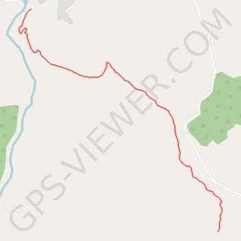
T2020-03-08-13-31
- Distance: 1.9 Km
- Elevation gain: 241 m
- Maximum elevation: 388 m
- Elevation loss: 11 m
- Minimum elevation: 157 m
- Moving time: 44 m 55 s
- Moving speed: 2.6 Km/h
- Maximum speed: 7.0 Km/h
- Total time: 49 m 18 s
- Global speed: 2.4 Km/h
- Date: 08/03/20
Interactive map
GPS track profile
About this GPS track
Name: T2020-03-08-13-31 GPS track, route, trail
Coordinates: 35.50993 -5.34154 35.51980 -5.33048
Other GPS tracks
Click on a GPS track to view route, its statistics and profile.
Maroc en boucle depuis Tanger
Maroc > pachalik de Tanger > Tanger
Distance: 3,028.7 Km • Elevation gain: 27,253 m • Maximum elevation: 2,301 m
Ceuta -> Ouarzazat -> Ceuta espagne
Distance: 804.6 Km • Elevation gain: 9,737 m • Maximum elevation: 2,191 m
Saved
Maroc > cercle de Tétouan > Zaïtoune
Distance: 7.2 Km • Elevation gain: 1,111 m • Maximum elevation: 1,205 m