Cathedral Range - Neds Peak
Interactive map
GPS track profile
About this GPS track
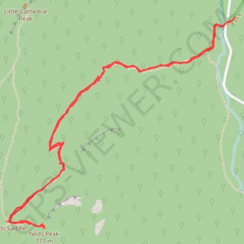
Name: Cathedral Range - Neds Peak GPS track, route, trail
Coordinates: -37.36734 145.73746 -37.35548 145.75350
Other GPS tracks
Click on a GPS track to view route, its statistics and profile.
The cathedral and the jawbones
Australia > Victoria > Rubicon
Distance: 12.6 Km • Elevation gain: 632 m • Maximum elevation: 817 m
Cathedral Range - Neds Peak
Australia > Victoria > Rubicon
Distance: 5.5 Km • Elevation gain: 447 m • Maximum elevation: 747 m
Tallarook - Eildon - Hurstbridge
Australia > Victoria > Tallarook
#Bike
Distance: 278.8 Km • Elevation gain: 4,897 m • Maximum elevation: 868 m